|
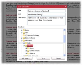
Education
Web
What is a Topographic Map?
represent lines of equal elevation above (or below) a reference datum. To visualize what a contour line represents, picture a mountain (or any other topographic feature) and imagine slicing through it with a perfectly flat, horizontal piece of glass. The intersection of the moun...
Topographic Model - Howard's Models
Topographic Model - Howard Models Topographic Model - Howard Models BACKYour custom topographic model is fabricated to your specifications. Howard Models - Topo Express Topographic Model Go to the Topo Portfolio Click here to contact us! Topographic Mo...
USGS Topographic Maps
USGS - Topographic Maps USGS Home Contact USGS Search USGS USGS Topographic Maps USGS Topographic Maps General information about topographic mapping General information about USGS maps Finding and ordering USGS topographic ...
Mapping Ancient Coastlines
National Science Content Standards 9-12: Origin and Evolution of the Earth System National Science Content Standards 9-12: Geochemical Cycles National Geography Standard 1: How to use maps and other geographic representations, tools, and technologies to acquire, process, and report informatio...
Mapping Potato Island
If you were taking a hike along a hillside and not walking either uphill or downhill, you would be walking on a contour line. When contour lines are close together, the slope is very steep. When contour lines are far apart, the slope is very shallow. This type of map is h...
Reading contour maps
Quia - Reading contour maps Home FAQ About Log in Subscribe now 30-day free trial Java Games: Flashcards, matching, concentration, and word search. Reading contour maps Tools Copy this to my account E-mail to a friend Find other activities Start over Return to c...
Introduction to Maps
Benefit the Environment Citizen Science Buzz Introduction to Maps Summary: Students are briefly introduced to several types of maps that are used for different purposes. Materials: Globe Road map Topographic map Raised relief map and/or shaded relief map Satellite phot...
Interpreting Ordnance Survey Maps
Quia - Interpreting Ordnance Survey Maps Home FAQ About Log in Subscribe now 30-day free trial Java Games: Flashcards, matching, concentration, and word search. Interpreting Ordnance Survey Maps Tools Copy this to my account E-mail to a friend Find other activities Start over R...
Cookie Mapping
that indicates the location and the type of features that the map shows. (For instance, "bedrock geology of an oatmeal raisin cookie"). Then label with name and class period. ASSESSMENT: 1. Before consuming cookies, number each sheet of paper that contains a cookie. 2. Record the...
The Mathematics Behind the Maps
The Most Colorful Math of All The Mathematics Behind the Maps How many different colors must you have available if you want to color a map so that countries that share a boundary line are not colored the same color? In the mid-1800's this problem became known among a small group of...
|